


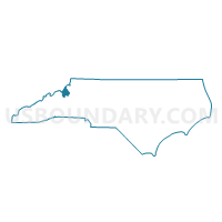
Voting District 17, Avery County, North Carolina
About
Outline

Summary
| Unique Area Identifier | 639312 |
| Name | Voting District 17 |
| County | Avery County |
| State | North Carolina |
| Area (square miles) | 14.01 |
| Land Area (square miles) | 14.01 |
| Water Area (square miles) | 0.00 |
| % of Land Area | 100.00 |
| % of Water Area | 0.00 |
| Latitude of the Internal Point | 36.02415230 |
| Longtitude of the Internal Point | -82.01902740 |
Maps


Graphs
Select a template below for downloading or customizing gragh for Voting District 17, Avery County, North Carolina


Neighbors
Neighoring Voting District (by Name) Neighboring Voting District on the Map
- Voting District 03, Mitchell County, NC
- Voting District 07, Avery County, NC
- Voting District 09, Avery County, NC
- Voting District 10, Avery County, NC
- Voting District 18, Avery County, NC
- Voting District 19, Avery County, NC
Top 10 Neighboring County Subdivision (by Population) Neighboring County Subdivision on the Map
- Ingalls township, Avery County, NC (2,930)
- Cane Creek township, Mitchell County, NC (771)
- Plumtree township, Avery County, NC (711)
- Pyatte township, Avery County, NC (516)
- Hughes township, Avery County, NC (490)
- Roaring Creek township, Avery County, NC (468)
- Frank township, Avery County, NC (296)
Top 10 Neighboring Unified School District (by Population) Neighboring Unified School District on the Map
Top 10 Neighboring State Legislative District Lower Chamber (by Population) Neighboring State Legislative District Lower Chamber on the Map
Top 10 Neighboring State Legislative District Upper Chamber (by Population) Neighboring State Legislative District Upper Chamber on the Map
Top 10 Neighboring 111th Congressional District (by Population) Neighboring 111th Congressional District on the Map
Top 10 Neighboring Census Tract (by Population) Neighboring Census Tract on the Map
- Census Tract 9304, Avery County, NC (5,329)
- Census Tract 9502, Mitchell County, NC (3,821)
- Census Tract 9303.02, Avery County, NC (3,130)